Sendayan,Lukut & Port Dickson/申达央、芦骨与波德申:
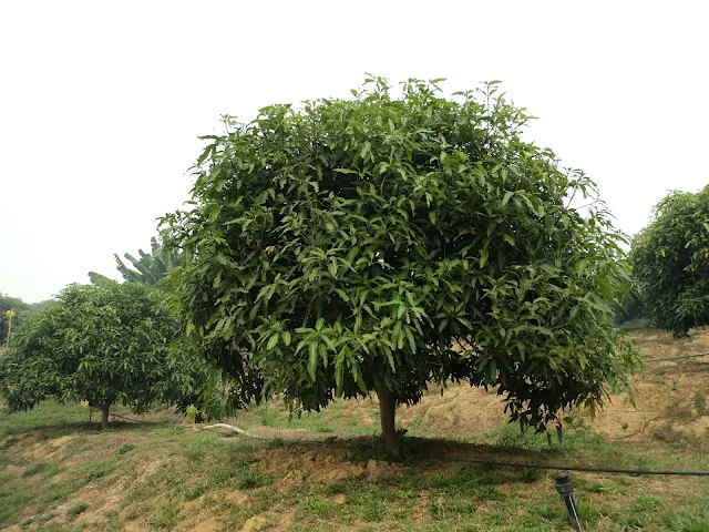
Sendayan is the new development township & industrial zone located near Seremban 2 and Lukut where is famous for the one of largest mosques of Negeri Sembilan known as Sri Sendayan Mosque has been titled as White Mosque, Taj Mahal of Negeri Sembilan & The Prophet's Mosque of Negeri Sembilan due to its white coloured exterior. Located not far from here is the Siliau(formerly known as Kampung Pengkalan) where is believed to be originated from pronunciation of Hokkien/Minnan dialect of Chinese words, 死了 means we are finished or death that famous for homemade prawn crackers of Sungai Sendayan which is made with shrimps, pepper & tapioca flour etc. called Double Shrimp Crackers(咔咔虾饼). They are also part of Malaysia Vision Valley.
申达央(另名为达城)是位于芙蓉新城与芦骨附近的新发展的市镇兼工业区,它也以因其白色外观而被誉为白色清真寺、森美兰的泰姬陵和森美兰先知寺的森美兰其中一间最大的清真寺达城清真寺闻名。位于这里不远处就是其名字相信是源自于中文死了的福建/闽南方言的发音Si Liau 的以双溪山打英的以咬其时发出的声音来命名的用虾、胡椒和木薯粉等制造出来的手工制造的炸虾饼咔咔虾饼闻名的西廖(前名为西料)。它们都是马来西亚宏愿谷的一部分。
Arrival Date/到达日期:
23 June 2013/二零一三年六月二十三日
9 March 2014/二零一四年三月九日
16 & 17 December 2017/二零一七年十二月十六日与十七日
26 May 2018/二零一八年五月二十六日
29 September 2024/二零二四年九月二十九日
Destination/目的地:
Sendayan/申达央:
 |
| Sendayan Valley Grape Farm/申达央谷葡萄园 |
申达央(另名为达城)是位于芙蓉新城与芦骨附近的新发展的市镇兼工业区,它也以因其白色外观而被誉为白色清真寺、森美兰的泰姬陵和森美兰先知寺的森美兰其中一间最大的清真寺达城清真寺闻名。位于这里不远处就是其名字相信是源自于中文死了的福建/闽南方言的发音Si Liau 的以双溪山打英的以咬其时发出的声音来命名的用虾、胡椒和木薯粉等制造出来的手工制造的炸虾饼咔咔虾饼闻名的西廖(前名为西料)。它们都是马来西亚宏愿谷的一部分。
Government Clinics/政府诊所:
1.Sendayan Health Clinic(Klinik Kesihatan)/申达央(达城)政府诊所
Google Map GPS Coordinate(approximately)/谷哥地图导览座标(估计性): 2.679028, 101.845528
1.Sendayan Health Clinic(Klinik Kesihatan)/申达央(达城)政府诊所
Google Map GPS Coordinate(approximately)/谷哥地图导览座标(估计性): 2.679028, 101.845528
Attractions in Sendayan/申达央景点:
The Tourist Attractions has been closed or current operating is unknown:
已关闭或目前经营乃不明确的旅游景点:
I.Sendayan Valley Grape & Fruit Farm/申达央谷葡萄园与果园:
 |
| Signboard of Main Gate of Sendayan Valley/申达央谷大门告示牌 |
 |
| Grapes/葡萄 |
 |
| Grapes/葡萄 |
 |
| Sendayan Valley/申达央谷 |
 |
| Sendayan Valley/申达央谷 |
 |
| Sendayan Valley/申达央谷 |
 |
| Sendayan Valley/申达央谷 |
Attractions:
i.Grape Farm
ii.Tapioca/Cassava Farm
iii.Eggplant Farm
iv.Rose Apple Farm
v.Guava Farm
vi.Apple Farm
vii.Mango Farm
The Things Must Do:
1.Take a look the vineyard & others vegetables farms & fruits orchards.
2.Buying some fresh fruits & vegetables in here.
Arrival Date
23 June 2013
*Maybe mistake in information.
Malay Name
Ladang Anggur Sendayan Valley
Location
Route 1265,Bandar Seri Sendayan
Google Map GPS Coordinate(approximately)
2.655183, 101.885129
申达央谷葡萄园与果园是种植着像名为黑色欧柏(Black Opal)等葡萄还拥有其他菜园与果园如番石榴/芭乐/鸡屎果与莲雾/水翁等的森美兰第一座葡萄园。葡萄是源自于北半球葡萄树的果实。
景点:
i.葡萄园
ii.木薯园
iii.茄子园
iv.莲雾/水翁园
v.番石榴/芭乐/鸡屎果园
vi.苹果园
vii.芒果园
一定要做的事:
1.观赏葡萄园与其它蔬果园。
2.在这里购买一些新鲜的蔬菜与水果。
到访日期
二零一三年六月二十三日
*资讯可能有错误。
马来名称
Ladang Anggur Sendayan Valley
位置
斯里申达央镇一二六五号公路
谷哥地图导览座标(估计性)
2.655183, 101.885129
Location Map/位置图:
END
结束
Lukut/芦骨:
 |
| Lukut Fort & Museum/芦骨堡垒与博物馆 |
The Things Must Do:
1.Learning the history of the Lukut Fort in the Lukut Fort & Museum.
2.Visiting the Alive 3D Art Gallery.
3.Playing the Awake Escape Room Games in Wild West Cowboy Indoor Theme Park.
4.Enjoying Dim Sum & Pau/Baozi at Hao Huo Xiang Coffee Shop.
5.Tasting the Curry Chicken Bun at Lucky King Bun.
6.Learning the Nipah Virus in the Sungai Nipah Time Tunnel Museum.
7.Tasting the Rougan/Chinese Jerky of Bukit Pelandok.
8.Tasting the Chinese pastries in Confectionery of Bukit Pelandok called 瑞珍饼家.
芦骨(另名为铁船头)是位于波德申附近前身是由雪兰莪苏丹王朝所控制的锡矿采矿区的市镇。位于芦骨不远处就是以肉干闻名的其名字源自于马来文因从前鼠鹿群吃了当地人种植在山上的木薯而得名的武吉不兰律(另名为狗头),它也是其华人以祖籍中国福建省东部的福州/闽东社群为多数的前立百病毒/尼帕病毒的发生地点之一兼前马来西亚最大的养猪区。它们都是马来西亚宏愿谷的一部分。
一定要做的事:
1.在芦骨堡垒与博物馆内了解芦骨堡垒的历史。
2.在Alive 三维立体画廊拍照。
3.在Wild West Cowboy 室内主题公园内的Awake 玩乐密室逃离游戏。
4.享用好和香包点的点心与包子。
5.品尝好运面包王的面包鸡。
6.在立百历史文化馆时光隧道内了解立百病毒/尼帕病毒。
7.品尝武吉不兰律/狗头的肉干。
8.品尝武吉不兰律/狗头瑞珍饼家的礼饼。
Attractions in Lukut/芦骨景点:
I.Lukut Fort & Museum/芦骨堡垒与博物馆
I.Lukut Fort & Museum/芦骨堡垒与博物馆
II.Dataran Segar City/世嘉城:
Government Clinics/政府诊所:
1.Lukut Health Clinic(Klinik Kesihatan)/芦骨政府诊所
Google Map GPS Coordinate(approximately)/谷哥地图导览座标(估计性): 2.576861, 101.837556
2.Bukit Pelandok Health Clinic(Klinik Kesihatan)/武吉不兰律政府诊所
Google Map GPS Coordinate(approximately)/谷哥地图导览座标(估计性): 2.638833, 101.760250
Attractions in Lukut/芦骨景点:
I.Lukut Fort & Museum/芦骨堡垒与博物馆:
1.Lukut Health Clinic(Klinik Kesihatan)/芦骨政府诊所
Google Map GPS Coordinate(approximately)/谷哥地图导览座标(估计性): 2.576861, 101.837556
2.Bukit Pelandok Health Clinic(Klinik Kesihatan)/武吉不兰律政府诊所
Google Map GPS Coordinate(approximately)/谷哥地图导览座标(估计性): 2.638833, 101.760250
I.Lukut Fort & Museum/芦骨堡垒与博物馆:
 |
| Staircase for getting up to the Lukut Fort/登上芦骨堡垒的阶梯 |
 |
| Lukut Fort Remains/芦骨堡垒遗址 |
 |
| Lukut Fort Remains/芦骨堡垒遗址 |
 |
| Lukut Museum/芦骨博物馆 |
 |
| Lukut Museum/芦骨博物馆 |
It is the former fortress of Selangor Sultanate located in Raja Hill/Gajah Mati Hill/Bukit Raja/Bukit Gajah Mati where is built in 1847 for defending the tin mining area from invaders has been described as National Heritage of Malaysia. A museum has been built for exhibiting the history of Lukut & Negeri Sembilan like rulers of Lukut including the late Raja Jumaat to late Raja Bot, the murder incident of Raja Busu & Captain Mcpherson's Report etc., heritage artifacts of Nassau Shipwreck, traditional industry technology of Malay community & culture of ethnic groups of Malaysia. The Kapitan(甲必丹)(Chinese leader) of Kuala Lumpur, late Mr.Yap Ah Loy(叶亚来/叶德来/叶茂兰) is also recently worked in here before migrating to Kuala Lumpur. The Tin ore is the material that used to make pewter, can, solder, chemicals, tin plating & tin alloy etc. The Selangor Sultanate is founded by the Raja Lumu/Sultan Salahuddin Shah on 1745.
Attractions:
i.Lukut Fort
ii.Lukut Museum
The Things Must Do:
i.Lukut Fort
ii.Lukut Museum
The Things Must Do:
1.Learning the history of Lukut Fort & the tin mining area by resources of museum.
2.Take a look the tin currency with different forms like fish, crocodile & grasshopper etc.
3.Learning the handicrafts from textiles to carpentry.
4.Looking the cannons of Lukut Fort.
5.Looking around the fort remains, poisonous well & Raja's Well on the hilltop.
Arrival Date
23 June 2013
*Maybe mistake in information.
Malay Name
Kota & Muzium Lukut
Location
Kampung Lukut Road/Jalan Kampung Lukut
Google Map GPS Coordinate(approximately)
2.568102, 101.821807
Opening Hours
9am-6pm, Closed on Eid'l Fitr/Hari Raya Aidilfitri & Eidul Adha/Hari Raya Aidiladha
Attention
1.Photography are not allowed in the museum.
2.Do not touch, climbing & sitting any exhibits items & the historical relics.
3.Pay attention of your children' altitudes.
Entrance Fee
Free
Website
www.jmm.gov.my/en
这是坐落在皇家山/死象山(Bukit Raja/Bukit Gajah Mati)上被列为马来西亚国家遗产的建于一八四六七年用来保卫锡矿采矿区的雪兰莪苏丹王朝时期的前堡垒。这儿已建立一间用以介绍芦骨与森美兰州的历史如包括已故拉惹祖玛安(Raja Jumaat)到已故拉惹博(Raja Bot)在内的芦骨统治者、拉惹布梳(Raja Busu)被杀事件与麦克弗森上尉报告(Captain Mcpherson's Report)等、纳少沉船(Nassau Shipwreck)的历史文物、马来社群传统行业技术与马来西亚民族文化的博物馆。吉隆坡的甲必丹(Kapitan)(华人领袖)已故叶亚来/叶德来/叶茂兰先生在还没迁徒到吉隆坡前曾经在这里工作过。锡矿是用来制作锡制品、罐头、焊锡、化学物品、镀锡板与锡合金等的材料。雪兰莪苏丹皇朝是由拉惹鲁姆/苏丹沙拉胡丁沙(Raja Lumu/Sultan Salahuddin Shah)于一七四五年所建立。
景点:
i.芦骨堡垒
ii.芦骨博物馆
一定要做的事:
1.通过博物馆资料了解芦骨堡垒与锡矿区的历史。
2.观看不同类型的锡制货币如鱼、鳄鱼与草蜢等。
3.了解从纺织品到木工的手工艺术品。
2.观看不同类型的锡制货币如鱼、鳄鱼与草蜢等。
3.了解从纺织品到木工的手工艺术品。
4.观看芦骨堡垒的大炮。
5.游览山顶上的堡垒遗址、毒井与拉惹井。
到访日期
二零一三年六月二十三日
*资讯可能有错误。
马来名称
Kota & Muzium Lukut
位置
甘榜芦骨路/Jalan Kampung Lukut
谷哥地图导览座标(估计性)
2.568102, 101.821807
开放时间
早上九点至傍晚六点,开斋节与古尔邦节/宰牲节休息
注意
(一)在博物馆内禁止拍照。
(二)禁止触摸、爬骑与蹲坐任何展示品与历史古迹。
(三)请注意你的孩子的行为。
入门票
免费
网址
www.jmm.gov.my/en
到访日期
二零一三年六月二十三日
*资讯可能有错误。
马来名称
Kota & Muzium Lukut
位置
甘榜芦骨路/Jalan Kampung Lukut
谷哥地图导览座标(估计性)
2.568102, 101.821807
开放时间
早上九点至傍晚六点,开斋节与古尔邦节/宰牲节休息
注意
(一)在博物馆内禁止拍照。
(二)禁止触摸、爬骑与蹲坐任何展示品与历史古迹。
(三)请注意你的孩子的行为。
入门票
免费
网址
www.jmm.gov.my/en
Location Map/位置图:
II.Dataran Segar City/世嘉城:
I)Alive 3D Art Gallery/Alive 三维立体画廊:
Arrival Date
17 December 2017
*Maybe mistake in information.
Location
Dataran Segar Road/Jalan Dataran Segar,Lukut
Google Map GPS Coordinate(approximately)
2.559963, 101.817415
Opening Hours
10am-7pm, Closed on Tuesday except Holidays
Entrance Fee
From RM20 to RM25 per person(Local)
I)Alive 3D Art Gallery/Alive 三维立体画廊:
 |
| Alive 3D Art Gallery/Alive 三维立体画廊 |
 |
| Alive 3D Art Gallery/Alive 三维立体画廊 |
 |
| Alive 3D Art Gallery/Alive 三维立体画廊 |
 |
| Alive 3D Art Gallery/Alive 三维立体画廊 |
It is the trick art gallery in the Dataran Segar City with the 3D murals that painted by artists from China like Ames Room, Alice in Wonderland Party, Chair & Gondola Ride etc. & also contains the first dark arts in Malaysia whose can taking photo with normal & flashlight. Furthermore, the gallery is also contains souvenirs shop & fun fair games like Angry Birds shooting games. The trick art is invented by the American artist called Mr.Kurt Wenner.
Arrival Date
17 December 2017
*Maybe mistake in information.
Location
Dataran Segar Road/Jalan Dataran Segar,Lukut
Google Map GPS Coordinate(approximately)
2.559963, 101.817415
Opening Hours
10am-7pm, Closed on Tuesday except Holidays
Entrance Fee
From RM20 to RM25 per person(Local)
From RM25 to RM30 per person(Foreigner)
Fun Fair Games: Below the RM5 per game
Website
segarcity.com
这间是坐落世嘉城内由来自中国的艺术家们所绘制出的如错觉屋、爱丽丝梦游仙境宴会、椅子以及贡多拉船等三维立体壁画的幻觉艺术画廊,它也是拥有以普通与闪光灯来拍照的全马来西亚第一群黑暗艺术的幻觉艺术画廊。另外,画廊也有纪念品店与如愤怒鸟(Angry Birds)射击游戏的游乐园游戏。幻觉艺术是由美国艺术家库尔特·温纳(Kurt Wenner)先生所发明。
到访日期
二零一七年十二月十七日
*资讯可能有错误。
位置
芦骨世嘉城路/Jalan Dataran Segar,Lukut
谷哥地图导览座标(估计性)
2.559963, 101.817415
开放时间
早上十点至晚上七点,星期二休息除了假期
入门票
一个人马币二十令吉至二十五令吉之间(本地人)
一个人马币二十五令吉至三十令吉之间(外国人)
游乐园游戏: 一个游戏马币低过五令吉
网址
segarcity.com
Location Map/位置图:
II)Wild West Cowboy Indoor Theme Park/Wild West Cowboy 室内主题公园:
 |
| Wild West Cowboy Indoor Theme Park/Wild West Cowboy 室内主题公园 |
 |
| Wild West Cowboy Indoor Theme Park/Wild West Cowboy 室内主题公园 |
 |
| Wild West Cowboy Indoor Theme Park/Wild West Cowboy 室内主题公园 |
 |
| Wild West Cowboy Indoor Theme Park/Wild West Cowboy 室内主题公园 |
Arrival Date
17 December 2017
*Maybe mistake in information.
Location
Dataran Segar Road/Jalan Dataran Segar,Lukut
Google Map GPS Coordinate(approximately)
2.559566, 101.818960
Opening Hours
10am-7pm, Closed on Tuesday except Holidays
Interactive Show Showing Time
Monday-Friday: 1.30pm
Weekends: 1pm & 4pm
Attention
Playing the entertainment facilities according to your health conditions in the park.
Entrance Fee
Free except Playing Games
Entrance Fee(Awake Escape Room Games)
Below the RM20 per person
Website
segarcity.com
Wild West Cowboy 室内主题公园是拥有互动游戏、街头游戏机、五维立体与七维立体电影院/戏院、纪念品店、密室逃离游戏与快餐店等的室内主题公园。Awake 密室逃离游戏是拥有像恐龙、木乃伊、鬼屋、童话世界与银河科幻等主题的密室。全世界第一间游乐园是丹麦哥本哈根的巴根游乐园。
到访日期
二零一七年十二月十七日
*资讯可能有错误。
位置
芦骨世嘉城路/Jalan Dataran Segar,Lukut
谷哥地图导览座标(估计性)
2.559566, 101.818960
开放时间
早上十点至晚上七点,星期二休息除了假期
互动表演演出时间
星期一至星期五:下午一点半
周末: 下午一点与下午四点
注意
以你的身体健康状况来玩公园内娱乐设施。
入门票
免费除了玩游戏
Awake 密室逃离游戏入门票
一个人马币低过二十令吉
网址
segarcity.com
Location Map/位置图:
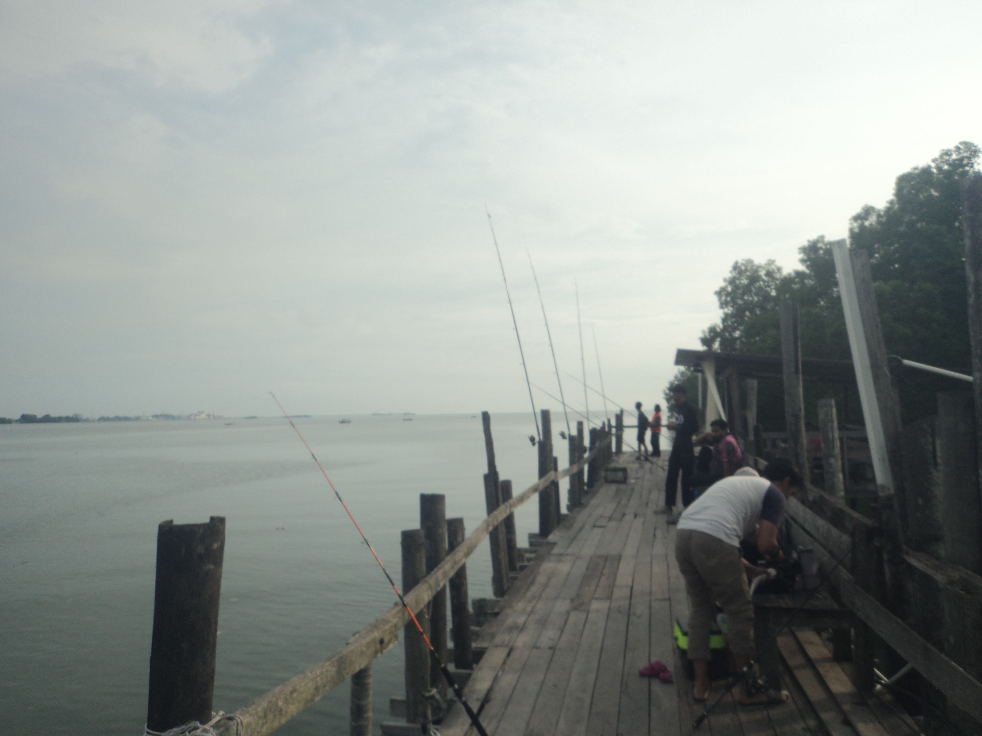
III.Kuala Lukut Fishing Kelong & Jetty/瓜拉芦骨筀笼与码头:
 |
| Kuala Lukut Fishing Kelong & Jetty/瓜拉芦骨筀笼与码头 |
 |
| Kuala Lukut Fishing Kelong & Jetty/瓜拉芦骨筀笼与码头 |
 |
| Kuala Lukut Fishing Kelong & Jetty/瓜拉芦骨筀笼与码头 |
 |
| Kuala Lukut Fishing Kelong & Jetty/瓜拉芦骨筀笼与码头 |
They are the two fishing jetties of Kuala Lukut which is consists of tourism fishing jetty & departure jetty of Mamod Kelong that can overlooking the Port Dickson. Kelong is the wooden offshore platform of Malaysia, Singapore, Indonesia & Philippines which is served as fishing or fish farming purposes.
Arrival Date
29 September 2024
*Maybe mistake in information.
Location
Kuala Lukut Road/Jalan Kuala Lukut,Lukut
Google Map GPS Coordinate(approximately)
2.583250, 101.789861(Tourism Fishing Jetty)
2.579500, 101.787250(Mamod Kelong)
Opening Hours
Unknown
Attention
Keeping the ocean clean.
Entrance Fee(Tourism Fishing Jetty)
Below the RM10 per person
Entrance Fee(Mamod Kelong)
Below the RM10 per person except Kelong
Mamod Kelong Boat Fee
Below the RM10 per person except Kelong
Mamod Kelong Boat Fee
Above the RM50 per person
它是可瞭望波德申的包含了观光钓鱼码头与前往马末筀笼的出发码头的瓜拉芦骨的两座钓鱼码头。筀笼是用作钓鱼与养鱼用途的马来西亚、新加坡、印尼与菲律宾的木制岸外平台。
到访日期
二零二四年九月二十九日
*资讯可能有错误。
位置
芦骨瓜拉芦骨路/Jalan Kuala Lukut,Lukut
到访日期
二零二四年九月二十九日
*资讯可能有错误。
位置
芦骨瓜拉芦骨路/Jalan Kuala Lukut,Lukut
谷哥地图导览座标(估计性)
2.583250, 101.789861(观光钓鱼码头)
2.579500, 101.787250(马末筀笼)
开放时间
不明确
注意
请保持海洋清洁。
入门票(钓鱼码头)
一个人马币低过十令吉
2.583250, 101.789861(观光钓鱼码头)
2.579500, 101.787250(马末筀笼)
开放时间
不明确
注意
请保持海洋清洁。
入门票(钓鱼码头)
一个人马币低过十令吉
入门票(马末筀笼)
一个人马币低过十令吉除了筀笼
马末筀笼船费
一个人马币高过五十令吉
一个人马币低过十令吉除了筀笼
马末筀笼船费
一个人马币高过五十令吉
Location Map/位置图:
IV.Sepang River Crossing Ferry Jetty/雪邦河渡河渡轮码头:
 |
| Sepang River Crossing Ferry Jetty/雪邦河渡河渡轮码头 |
 |
| Sepang River Crossing Ferry Jetty/雪邦河渡河渡轮码头 |
 |
| Sepang River Crossing Ferry Jetty/雪邦河渡河渡轮码头 |
It is the ferry services between Bukit Pelandok & Sungai Pelek to transport the passengers, motorcycles & bicycles across the Sepang River/Sungai Sepang which is marked the state border between the Negeri Sembilan & Selangor. The jetty is also the filming site of the Malaysian film, "Think Big Big"(大大哒). Except for that, visitors can also renting boat for angling in here.
Arrival Date
26 May 2018
*Maybe mistake in information.
Location
Route N4,Bukit Pelandok
Google Map GPS Coordinate(approximately)
2.638657, 101.726811(Bukit Pelandok,Negeri Sembilan)
2.638866, 101.725325(Sungai Pelek,Selangor)
Opening Hours
6.35am-7.25pm
Operating Hours(Renting the Boat for Angling)
8am-6pm
Tel for Renting the Boat for Angling
016-6537111
Attention
Keeping the river & forest clean.
Entrance Fee
Below the RM5 per person
Angling Boat Rental Fee
Below the RM200 per boat
这是载送乘客、摩托车/电单车/机车与自行车/脚踏车/单车越过用以标记着森美兰与雪兰莪之间的州界的雪邦河来往武吉不兰律/狗头与双溪比力的渡轮服务。码头也是马来西亚电影《大大哒》的取景地。除此之外,游客也可在这里租船来钓鱼。
到访日期
二零一八年五月二十六日
*资讯可能有错误。
位置
武吉不兰律(狗头)N4 号公路/Bukit Pelandok
谷哥地图导览座标(估计性)
2.638657, 101.726811(森美兰州武吉不兰律/狗头)
2.638866, 101.725325(雪兰莪州双溪比力)
开放时间
凌晨六点三十五分至晚上七点二十五分
租船钓鱼运作时间
早上八点至傍晚六点
租船钓鱼拨电
016-6537111
注意
请保持河流与森林的清洁。
入门票
一个人马币低过五令吉
租船钓鱼费
一艘船马币低过两百令吉
Location Map/位置图:
V.Sungai Nipah Time Tunnel Museum/立百历史文化馆时光隧道:
 |
| Sungai Nipah Time Tunnel Museum/立百历史文化馆时光隧道 |
 |
| Sungai Nipah Time Tunnel Museum/立百历史文化馆时光隧道 |
 |
| Sungai Nipah Time Tunnel Museum/立百历史文化馆时光隧道 |
 |
| Sungai Nipah Time Tunnel Museum/立百历史文化馆时光隧道 |
 |
| Sungai Nipah Time Tunnel Museum/立百历史文化馆时光隧道 |
 |
| Wishing Tree/许愿树 |
 |
| Hock Leong Kong & Kim Hong Shi Temple/福龙宫金凤寺 |
Sungai Nipah Time Tunnel Museum is the museum located inside the opera stage of Hock Leong Kong & Kim Hong Shi Temple that exhibiting the history of Sungai Nipah New Village/Kampung Baru Sungai Nipah, the operation methods of the pig farming & the history of Nipah Virus Tragedy & also selling the pig themed souvenirs. The domestic pigs are the one of most populous mammals in the world & also the omnivorous animals. The Nipah Virus is the deadly virus which is named after the Sungai Nipah New Village/Kampung Baru Sungai Nipah that originated from bats & infected the pigs before the human. Malaysian Chinese New Village/Kampung Baru(新村) is the Chinese village that formed during the Malayan Emergency era. Furthermore, visitors can also going to visit the Hock Leong Kong & Kim Hong Shi Temple where is the Chinese temple that dedicated to Chinese folk deities like the Chinese God of Land, Lord Tua Pek Kong/Tudigong/Dagogong/Fudezhensheng(福德正神/大伯公/土地公) & Chinese, Buddhist & Taoist Goddess of Mercy called Lord Avalokiteśvara(观音菩萨/观音大士) etc. for receiving a wishing ribbon by donation to make wish in the wishing tree. The Chinese temple architectural style is the temple that constructed based on Chinese philosophy called Feng Shui(风水) with the structure features like dougong/wooden bracket system(斗拱), curved roof & eaves etc.
The Things Must Do:
1.Learning the road names of Sungai Nipah New Village that named after the local fruits.
2.Learning the naming of Sungai Nipah New Village.
3.Learning about the nickname of Sungai Nipah called Ang Chu Gia/Red Houses.
4.Learning about the Nipah Virus.
5.Taking a look the old newspapers that recorded the Nipah Virus Tragedy.
Arrival Date
26 May 2018
*Maybe mistake in information.
Location
Route N4,Sungai Nipah New Village/Kampung Baru Sungai Nipah
Google Map GPS Coordinate(approximately)
2.626814, 101.745431
Opening Hours
Weekends: 9am-5pm
Tel for Appointment during Monday-Friday
012-3618728
012-3881688
012-6365388
010-3661815
012-6189353
Attention
1.Do not touch, climbing & sitting any exhibits items.
2.Pay attention of your children' altitudes.
3.Do not acting any indecent behaviour inside the temple area.
Entrance Fee
Below the RM10 per person
立百历史文化馆时光隧道是坐落在福龙宫金凤寺的戏台内展览着立百新村的历史、养猪业运作方式与立百病毒/尼帕病毒事件历史还有售卖着猪主题的纪念品的博物馆。家猪是全世界数量最多的哺乳类动物之一兼杂食性动物。立百病毒/尼帕病毒是以立百新村命名源自于蝙蝠及感染猪只后感染人类的致命性病毒。新村(Kampung Baru)是马来亚紧急状态时期形成的华人村庄。另外,游客也可到访供奉着如华人土地神福德正神/大伯公/土地公与华人民间信仰、佛教兼道教慈悲神明观音菩萨/观音大士等华人民间神明的华人庙宇福龙宫金凤寺以捐赠方式来获取许愿带在许愿树下许愿。中式/汉式庙宇建筑风格是根据华人/汉人风水哲理来建造像斗栱/木制支架系统、曲线型屋顶与屋檐等建筑特色的庙宇。
一定要做的事:
1.了解立百新村以当地水果来命名的路名。
2.了解立百新村的名字来源。
3.了解立百新村的外号红屋子。
4.了解立百病毒/尼帕病毒。
5.观看记录着立百病毒/尼帕病毒事件的旧报纸。
到访日期
二零一八年五月二十六日
*资讯可能有错误。
位置
立百新村N4 号公路/Kampung Baru Sungai Nipah
谷哥地图导览座标(估计性)
2.626814, 101.745431
开放时间
周末: 早上九点至傍晚五点
星期一至星期五预约拨电
012-3618728
012-3881688
012-6365388
010-3661815
012-6189353
注意
(一)禁止触摸、爬骑与蹲坐任何展示品。
(二)请注意你的孩子的行为。
(三)禁止在庙宇范围作出不雅行为。
入门票
一个人马币低过十令吉
Location Map/位置图:
已关闭或目前经营乃不明确的旅游景点:
I.Bai Ji Xuan Boathouse/百吉轩船屋:
Arrival Date
16 December 2017
*Maybe mistake in information.
Location
Route N4,Bukit Pelandok
Google Map GPS Coordinate(approximately)
2.660125, 101.746833
百吉轩船屋是坐落在森美兰与雪兰莪之间的州界的雪邦河的河边的含有餐馆、自制水上自行车/水上脚踏车/水上单车与雪邦河游船的船屋,船屋也是马来西亚电影《大大哒》的取景地。另外,雪邦河游船是可看见雪邦河河口、雪邦黄金海岸AVANI 渡假村、日落、用以载送人们、摩托车/电单车/机车与自行车/脚踏车/单车来往雪兰莪的双溪比力与森美兰的武吉不兰律/狗头的雪邦河的渡轮服务以及雪邦河的红树林的游船服务。红树林是在热带地区与亚热带/副热带地区出现由生长在黑色水域的红树组成的滨海生态系统,它可以保护滨海区逃离侵蚀、风暴与海啸。
I.Bai Ji Xuan Boathouse/百吉轩船屋:
 |
| Bai Ji Xuan Boathouse/百吉轩船屋 |
 |
| Bai Ji Xuan Boathouse/百吉轩船屋 |
 |
| Bai Ji Xuan Boathouse/百吉轩船屋 |
 |
| Sepang River Cruise/雪邦河游船 |
Bai Ji Xuan Boathouse is the boathouse located in the riverside of the Sepang River/Sungai Sepang which is marked the state border between the Negeri Sembilan & Selangor that contains restaurant, handmade water cycle & Sepang River Cruise, the boathouse also the filming site of the Malaysian film, "Think Big Big"(大大哒). Furthermore, the Sepang River Cruise is the river cruise services where can overlooking the river estuary of Sepang River, the AVANI Sepang Gold Coast Resort, sunset, the ferry services for transporting the people, motorcycles & bicycles to across the Sepang River/Sungai Sepang between the Sungai Pelek of Selangor & Bukit Pelandok of Negeri Sembilan and the mangrove forest of Sepang River. The Mangrove Forest is the coastal ecosystem that occurs in tropical region & subtropics region with mangrove trees whose are growth in the blackish water, it can protecting the coastal area from erosion, tsunami & storms.
Arrival Date
16 December 2017
*Maybe mistake in information.
Location
Route N4,Bukit Pelandok
Google Map GPS Coordinate(approximately)
2.660125, 101.746833
百吉轩船屋是坐落在森美兰与雪兰莪之间的州界的雪邦河的河边的含有餐馆、自制水上自行车/水上脚踏车/水上单车与雪邦河游船的船屋,船屋也是马来西亚电影《大大哒》的取景地。另外,雪邦河游船是可看见雪邦河河口、雪邦黄金海岸AVANI 渡假村、日落、用以载送人们、摩托车/电单车/机车与自行车/脚踏车/单车来往雪兰莪的双溪比力与森美兰的武吉不兰律/狗头的雪邦河的渡轮服务以及雪邦河的红树林的游船服务。红树林是在热带地区与亚热带/副热带地区出现由生长在黑色水域的红树组成的滨海生态系统,它可以保护滨海区逃离侵蚀、风暴与海啸。
到访日期
二零一七年十二月十六日
*资讯可能有错误。
位置
武吉不兰律(狗头)N4 号公路/Bukit Pelandok
谷哥地图导览座标(估计性)
2.660125, 101.746833
Location Map/位置图:
Food around Lukut/芦骨周围美食:
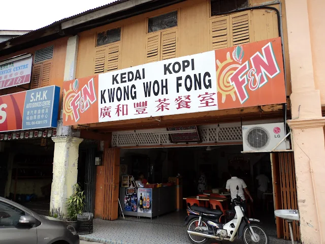
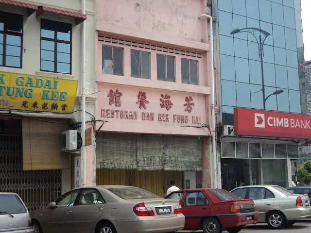
In the Lukut, visitors can tasting the Chinese steamed bun/Pau/Baozi called Emperor Pau which is stuffed by glutinous minced meat rice & homemade coffee of Hao Huo Xiang Coffee Shop, the Curry Chicken Bun of Lucky King Bun which is the huge baked bun that fulfilled with curry chicken meats & also the Dirty Mee which is the noodles dish with frying version, dry mixing version and noodles soup version of 面久拉揸面 that named after the Cantonese pronunciation words of dirty called La Zha due to its former noodles stall near the drainage. Pau/Baozi is believed to be founded by the military strategist called Zhuge Liang(诸葛亮) from Three Kingdoms(三国) era of China. Curry is the Indian dishes that combination of herbs & spices from India. In the Bukit Pelandok, visitors can buying the local homemade Rougan/Chinese Jerky which is originated from China in the several cottage industries like Lim Kee(Twin Deer Brand) etc. & the mung bean paste filled bean paste biscuits & maltose biscuits & the sesame biscuits with empty filled which is the Fuzhou/Foochow mooncake that made with dough & sesame by baking inside the special made urn shaped charcoal stove in the confectionery called 瑞珍饼家, the sesame biscuit of 瑞珍饼家 is the biscuit can be served with coffee which is only made during the festive season of Mid Autumns Festival that need to buy it by reservation first. Mooncake is the traditional Chinese pastry that symbolized reunion which usually eaten after praying the God of Moon during Mid Autumn Festival.
在芦骨,游客可品尝到好和香包点的用糯米肉碎馅料制作的名为皇帝包的包点/包子与自家泡制咖啡、好运面包王的涵盖着咖哩鸡肉的巨型烘面包的面包鸡还有面久拉揸面的因从前面摊坐落在沟渠旁而以肮脏在粤语/广东话/广府话方言的称呼La Zha来命名的拉揸面的含有炒的版本、干拌/干捞版本与汤面版本的面食。包子是相信是由中国三国时期的军事家诸葛亮所发明。咖哩是以印度草本香料混合出来的印度佳肴。在武吉不兰律/狗头,游客可以在如林记肉干肉丝行(双鹿商标)等的多间家庭企业购买到当地自家生产的发源于中国的肉干以及在瑞珍饼家购买到以绿豆沙为馅料的豆沙饼、以麦芽糖为馅料的麦芽饼以及使用芝麻与面团来制造在特制瓮形炭火锅炉烘烤出来的可配搭咖啡来吃的无馅料福州月饼炭烧麻饼/木头饼/柴头饼/打战饼/发霉饼/芝麻饼,瑞珍饼家的炭烧麻饼/木头饼/柴头饼/打战饼/发霉饼/芝麻饼是在中秋节节庆季节期间才制造需预订先才能买到的礼饼。月饼是在中秋节期间祭月之后才吃象征着团圆的汉人/华人传统糕饼。
 Hao Huo Xiang Emperor Pau/Steamed Glutinous Rice Minced Meat Bun,Big Pau/Da Ba/Big Chinese Steamed Bun & Coffee
好和香皇帝包/糯米肉碎包、大包与咖啡
Location/位置: Seremban Road(Route 5)/Jalan Seremban,Lukut
Google Map GPS Coordinate(approximately)/谷哥地图导览座标(估计性): 2.567630, 101.828165
Tel for Reservations/预订拨电: 06-6513429/016-3206969
In the Lukut, visitors can tasting the Chinese steamed bun/Pau/Baozi called Emperor Pau which is stuffed by glutinous minced meat rice & homemade coffee of Hao Huo Xiang Coffee Shop, the Curry Chicken Bun of Lucky King Bun which is the huge baked bun that fulfilled with curry chicken meats & also the Dirty Mee which is the noodles dish with frying version, dry mixing version and noodles soup version of 面久拉揸面 that named after the Cantonese pronunciation words of dirty called La Zha due to its former noodles stall near the drainage. Pau/Baozi is believed to be founded by the military strategist called Zhuge Liang(诸葛亮) from Three Kingdoms(三国) era of China. Curry is the Indian dishes that combination of herbs & spices from India. In the Bukit Pelandok, visitors can buying the local homemade Rougan/Chinese Jerky which is originated from China in the several cottage industries like Lim Kee(Twin Deer Brand) etc. & the mung bean paste filled bean paste biscuits & maltose biscuits & the sesame biscuits with empty filled which is the Fuzhou/Foochow mooncake that made with dough & sesame by baking inside the special made urn shaped charcoal stove in the confectionery called 瑞珍饼家, the sesame biscuit of 瑞珍饼家 is the biscuit can be served with coffee which is only made during the festive season of Mid Autumns Festival that need to buy it by reservation first. Mooncake is the traditional Chinese pastry that symbolized reunion which usually eaten after praying the God of Moon during Mid Autumn Festival.
在芦骨,游客可品尝到好和香包点的用糯米肉碎馅料制作的名为皇帝包的包点/包子与自家泡制咖啡、好运面包王的涵盖着咖哩鸡肉的巨型烘面包的面包鸡还有面久拉揸面的因从前面摊坐落在沟渠旁而以肮脏在粤语/广东话/广府话方言的称呼La Zha来命名的拉揸面的含有炒的版本、干拌/干捞版本与汤面版本的面食。包子是相信是由中国三国时期的军事家诸葛亮所发明。咖哩是以印度草本香料混合出来的印度佳肴。在武吉不兰律/狗头,游客可以在如林记肉干肉丝行(双鹿商标)等的多间家庭企业购买到当地自家生产的发源于中国的肉干以及在瑞珍饼家购买到以绿豆沙为馅料的豆沙饼、以麦芽糖为馅料的麦芽饼以及使用芝麻与面团来制造在特制瓮形炭火锅炉烘烤出来的可配搭咖啡来吃的无馅料福州月饼炭烧麻饼/木头饼/柴头饼/打战饼/发霉饼/芝麻饼,瑞珍饼家的炭烧麻饼/木头饼/柴头饼/打战饼/发霉饼/芝麻饼是在中秋节节庆季节期间才制造需预订先才能买到的礼饼。月饼是在中秋节期间祭月之后才吃象征着团圆的汉人/华人传统糕饼。
好和香皇帝包/糯米肉碎包、大包与咖啡
Location/位置: Seremban Road(Route 5)/Jalan Seremban,Lukut
Google Map GPS Coordinate(approximately)/谷哥地图导览座标(估计性): 2.567630, 101.828165
Tel for Reservations/预订拨电: 06-6513429/016-3206969
Location Map/位置图:
Location/位置: Pusat Perniagaan Lukut Utama 1 Road/Jalan Pusat Perniagaan Lukut Utama 1,Lukut
Dirty Mee
面久拉揸面Location/位置: Pusat Perniagaan Lukut Utama 1 Road/Jalan Pusat Perniagaan Lukut Utama 1,Lukut
兴记烧肉档
Location/位置:
Pasar Road/Jalan Pasar,Lukut(Lukut Market during Morning/早上在芦骨市场)
Main Road/Jalan Besar,Lukut(Noon of Friday-Sunday and Holidays/星期五至星期日与假期的中午)
Google Map GPS Coordinate(approximately)/谷哥地图导览座标(估计性):
2.566354, 101.827410(Lukut Market during Morning/早上在芦骨市场)
2.568417, 101.828361(Noon of Friday-Sunday and Holidays/星期五至星期日与假期的中午)
Chop Siew Tham Mooncake(only selling mooncakes during festive season of Mid Autumn Festival)
萧谭酒庄月饼(月饼只在中秋节节庆季节期间售卖)
Location/位置: Main Road/Jalan Besar,Lukut
Google Map GPS Coordinate(approximately)/谷哥地图导览座标(估计性): 2.568667, 101.828444
萧谭酒庄月饼(月饼只在中秋节节庆季节期间售卖)
Location/位置: Main Road/Jalan Besar,Lukut
Google Map GPS Coordinate(approximately)/谷哥地图导览座标(估计性): 2.568667, 101.828444

好运面包王面包鸡
Location/位置: Main Road/Jalan Besar,Lukut
Google Map GPS Coordinate(approximately)/谷哥地图导览座标(估计性): 2.568559, 101.828328
Tel for Reservations/预订拨电: 06-6512392/018-2652622
Location Map/位置图:


 Lim Kee Rougan/Chinese Jerky
林记肉干肉丝行
Location/位置: No.7,Haiwan Road/Jalan Haiwan,Bukit Pelandok
Google Map GPS Coordinate(approximately)/谷哥地图导览座标(估计性): 2.655221, 101.755007
Tel for Reservations/预订拨电: 012-2862136/019-6990303/017-3351800/014-2222086
Location Map/位置图:
Kwai So Noodles(Seafood Noodles)
贵嫂面/拉揸面(海鲜面)
Location/位置: Seremban Road(Route 5)/Jalan Seremban,Lukut
Google Map GPS Coordinate(approximately)/谷哥地图导览座标(估计性): 2.564250, 101.816083
贵嫂面/拉揸面(海鲜面)
Location/位置: Seremban Road(Route 5)/Jalan Seremban,Lukut
Google Map GPS Coordinate(approximately)/谷哥地图导览座标(估计性): 2.564250, 101.816083
Jeng Kee Fuzhou/Foochow Cuisine
正记福州菜肴
Location/位置: Kg.Tanah Merah Site C Road/Jalan Kg.Tanah Merah Site C,Tanah Merah New Village Site C
正记福州菜肴
Location/位置: Kg.Tanah Merah Site C Road/Jalan Kg.Tanah Merah Site C,Tanah Merah New Village Site C

HSZ Restaurant Chinese Cuisine & Vietnam Coffee(Night)
后生客栈中式佳肴与越南咖啡(晚上)
Location/位置: Kedai Road/Jalan Kedai,Sungai Nipah
Location Map/位置图:
后生客栈中式佳肴与越南咖啡(晚上)
Location/位置: Kedai Road/Jalan Kedai,Sungai Nipah
Location Map/位置图:

Tai Heng Fuat Western Cuisine(Night)
太兴发西式佳肴/西餐(晚上)
Location/位置: Kedai Road/Jalan Kedai,Sungai Nipah
Location Map/位置图:
Location/位置: Kedai Road/Jalan Kedai,Sungai Nipah
Location Map/位置图:
林记肉干肉丝行
Location/位置: No.7,Haiwan Road/Jalan Haiwan,Bukit Pelandok
Google Map GPS Coordinate(approximately)/谷哥地图导览座标(估计性): 2.655221, 101.755007
Tel for Reservations/预订拨电: 012-2862136/019-6990303/017-3351800/014-2222086
Location Map/位置图:
Tiong Seng Braised Chicken Feet
张盛姐弟卤鸡脚
Location/位置: Route N4,Bukit Pelandok
Google Map GPS Coordinate(approximately)/谷哥地图导览座标(估计性): 2.648583, 101.748167
张盛姐弟卤鸡脚
Location/位置: Route N4,Bukit Pelandok
Google Map GPS Coordinate(approximately)/谷哥地图导览座标(估计性): 2.648583, 101.748167
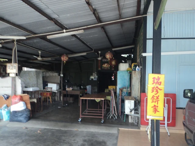
瑞珍饼家炭烧麻饼/木头饼/柴头饼/打战饼/发霉饼/芝麻饼/芝麻饼、豆沙饼/绿豆沙饼与麦芽饼
Location/位置: No.86,Route N4,Bukit Pelandok
Google Map GPS Coordinate(approximately)/谷哥地图导览座标(估计性): 2.648365, 101.747860
Tel for Reservations/预订拨电: 012-6259190/06-6672411
Location/位置: No.86,Route N4,Bukit Pelandok
Google Map GPS Coordinate(approximately)/谷哥地图导览座标(估计性): 2.648365, 101.747860
Tel for Reservations/预订拨电: 012-6259190/06-6672411
Location Map/位置图:
Long Seng Fuzhou/Foochow Biscuits
隆盛福州饼类
Location/位置: Merpati 1 Road/Jalan Merpati 1,Bukit Pelandok
隆盛福州饼类
Location/位置: Merpati 1 Road/Jalan Merpati 1,Bukit Pelandok
Loong Hin Pau/Baozi/Chinese Steamed Buns & Dim Sum
隆兴包子与点心
Location/位置: Jentayu 1 Road/Jalan Jentayu 1,Bukit Pelandok
隆兴包子与点心
Location/位置: Jentayu 1 Road/Jalan Jentayu 1,Bukit Pelandok

龙珠果园火龙果/仙蜜果与菠萝/黄梨/凤梨
Location/位置: Route 5,Bukit Pelandok
Google Map GPS Coordinate(approximately)/谷哥地图导览座标(估计性): 2.675636, 101.760796
Location Map/位置图:
Markets around Lukut/芦骨周围市场:
Lukut Central Market
芦骨中央市场
Location/位置: Pasar Road/Jalan Pasar,Lukut
END
结束
Port Dickson/波德申:
Port Dickson(formerly known as Arang/Tanjung) is the district capital of Port Dickson District & also the local government seat of Port Dickson Municipal Council/Majlis Perbandaran Port Dickson where is contains the petroleum refineries, bus terminal & public hospital that formerly contains the terminus of former railway track between the Port Dickson & Seremban has been titled as National Beach Resort/Pantai Peranginan Negara & Army City/Bandar Tentera Darat of Malaysia because it contains a lot of beaches and army camps. The name of second largest city of Negeri Sembilan is derived from the former port where is named after a British officer, late Mr.John Frederick Dickson. The Port Dickson District is also contains the Pengkalan Kempas/Pongkalan Kompeh located near the Linggi River/Sungai Linggi where is hundred years old ancient town & also former landing site of early Chinese pioneers of the Negeri Sembilan that famous for its fishermen's pier with archway, only hundred years old grocery shop called Chin Choo Huat(振裕发), only Chinese coffee shop called Jit Sing(日新), murals & mural alley called Dog Dung Lane(狗屎巷) etc., giant freshwater prawns, crocodiles and Pengkalan Kempas Historical Complex/Pengkalan Kempas Megalithic Complex with megalithic site(also known as "Living Stones" by Malay community) & megalith gallery etc. has been listed as National Heritage of Malaysia. Furthermore, the Port Dickson is also contains the PD Waterfront which is the seafront commercial zone under development of local Malaysian enterpreneur called TSR Capital Berhad that famous for its largest pink sand beach of Malaysia, famous Avillion Admiral Marina with accommodation facilities and Lexis Hibiscus Port Dickson which is hibiscus shaped like luxury resort which is also the most swimming pools in a resort of the world about 643 pools & most overwater villa in a single resort of the world about 522 villas. Besides that, the longest recorded capture King Cobra specimen of the world & also longest venomous snake specimen of the world about 5.71m long was found in the Port Dickson on 1939 but its settled zoo in the London of Great Britain has been destroyed during the World War II. Port Dickson is also part of Malaysia Vision Valley.
结束
Port Dickson/波德申:
 |
| Teluk Kemang Beach/直落甘望海滩 |
The Things Must Do:
1.Doing beach activities on Teluk Kemang Beach.
2.Learning the history of army of Malaysia in Port Dickson Army Museum.
3.Visiting the Port Dickson Ornamental Fish Centre.
4.Bird watching around the exclave of Malacca called Cape Rachado/Tanjung Tuan.
波德申(前名为阿郎)是拥有石油提炼厂、公车/巴士总站与公共医院以及从前拥有前波德申与芙蓉之间的火车轨道的终站的波德申县的县府兼波德申市议会(Majlis Perbandaran Port Dickson)的地方政府所在地。这座因有许多海滩以及军营而被誉为为马来西亚国家海滩度假城与陆军城森美兰第二大城市的名字是以一位英国官员已故约翰·弗德利·德申(John Frederick Dickson)先生的名字来命名的港口而来。波德申县也拥有坐落在宁宜河旁以含有牌坊的渔夫码头、唯一的百年杂货店振裕发、唯一的华人咖啡店日新茶室、壁画与壁画巷狗屎巷等的老街场、淡水长臂虾/马来西亚大虾/罗氏沼虾/白脚虾/金钱虾/万氏对虾/大头虾、鳄鱼以及被列为马来西亚国家遗产的拥有被马来社群称为“活石头” 的马来巨石阵与马来巨石阵展览厅的船头历史广场/船头马来巨石阵广场闻名的从前为森美兰早期华人先驱者们的登陆地点的百年古镇船头。另外,波德申也拥有以其马来西亚最大的粉红沙滩闻名的马来西亚本地企业林叶资本(TSR Capital Berhad)所发展的海滨商业区波德申海洋城、包含了住宿设施的海中天游艇码头以及拥有约六百四十三座游泳池的全世界含有最多游泳池的度假村及约五百二十二间水上别墅的全世界拥有最多水上别墅的单一度假村的两项纪录的相似木槿花/大红花形状的豪华度假村波德申丽昇大红花度假村。除此之外,约五点七一米长的全世界最长的被捕获的眼镜蛇王标本兼全世界最长的毒蛇标本在一九三九年于波德申内发现但安置它的英国伦敦的动物园已在第二世界大战期间遭摧毁。波德申也是马来西亚宏愿谷的一部分。
一定要做的事:
1.在直落甘望海滩进行海滩活动。
2.在波德申陆军博物馆了解马来西亚陆军的历史。
3.参观波德申观赏鱼中心。
4.在马六甲的外飞地拉查多角/丹绒端周围进行观鸟活动。
Attractions in Port Dickson/波德申景点:
I.Beaches in Port Dickson/波德申海滩:
i.Tanjung Gemok Beach/丹绒葛末海滩
ii.Bagan Pinang Beach/峇眼槟榔海滩
iii.Saujana Beach/少佳纳海滩(四英里海滩)
iv.Cahaya Negeri Beach/查哈雅惹葛里海滩
v.Teluk Kemang Beach/直落甘望海滩
vi.Purnama Beach/普南马海滩
vii.Blue Lagoon Beach/蓝珊瑚湾海滩
I.Beaches in Port Dickson/波德申海滩:
i.Tanjung Gemok Beach/丹绒葛末海滩
ii.Bagan Pinang Beach/峇眼槟榔海滩
iii.Saujana Beach/少佳纳海滩(四英里海滩)
iv.Cahaya Negeri Beach/查哈雅惹葛里海滩
v.Teluk Kemang Beach/直落甘望海滩
vi.Purnama Beach/普南马海滩
vii.Blue Lagoon Beach/蓝珊瑚湾海滩
Government Clinics/政府诊所:
1.Port Dickson Health Clinic(Klinik Kesihatan)/波德申政府诊所
Google Map GPS Coordinate(approximately)/谷哥地图导览座标(估计性): 2.528472, 101.792000
2.Bagan Pinang Health Clinic(Klinik Kesihatan)/峇眼槟榔政府诊所
Google Map GPS Coordinate(approximately)/谷哥地图导览座标(估计性): 2.504333, 101.835944
3.Pasir Panjang Health Clinic(Klinik Kesihatan)/老港政府诊所
Google Map GPS Coordinate(approximately)/谷哥地图导览座标(估计性): 2.428889, 101.937250
4.Linggi Health Clinic(Klinik Kesihatan)/宁宜政府诊所
Google Map GPS Coordinate(approximately)/谷哥地图导览座标(估计性): 2.483167, 102.017917
Attractions in Port Dickson/波德申景点:
I.Beaches in Port Dickson/波德申海滩:
*All Free Admission/全部免费入场
The beach is the coastal landform that formed with the sands, gravel, pebble & rocks etc. that carried by the waves to the area. The Port Dickson beaches are facing the Straits of Malacca.
Attention
1.Keeping the beach area clean.
2.Do not collect the marine resources like seashells & corals etc.
3.Do not soak in the water while you are applied the sunscreen lotion.
4.Do not bath with soap, body shampoo & shampoo in here.
海滩是一种由海浪带来这个地区的沙、砾石、鹅卵石与石头等形成的滨海地形。波德申的海滩都面向马六甲海峡。
注意
(一)请保持海滩的清洁。
(二)禁止收集像贝壳与珊瑚等海洋资源。
(三)禁止以擦上防晒露/防晒油来浸泡在水里。
(四)禁止用肥皂、沐浴露与洗发水来在这里洗澡。
Location/位置: Route 5/五号公路

Tanjung Gemok Beach/丹绒葛末海滩
It is the beach where can angling & watching sunset.
它是可垂钓与观赏日落的海滩。
Arrival Date/到访日期: 29 September 2024/二零二四年九月二十九日
*Maybe mistake in information./资讯可能有错误。
Malay Name/马来名称: Pantai Tanjung Gemok
Google Map GPS Coordinate(approximately)/谷哥地图导览座标(估计性): 2.545028, 101.798944
*Maybe mistake in information./资讯可能有错误。
Malay Name/马来名称: Pantai Tanjung Gemok
Google Map GPS Coordinate(approximately)/谷哥地图导览座标(估计性): 2.545028, 101.798944
Location Map/位置图(Pay attention for signboards/请注意路牌):

It is the non-camping site of Port Dickson.
Arrival Date/到访日期: 23 June 2013/二零一三年六月二十三日
*Maybe mistake in information./资讯可能有错误。
Malay Name/马来名称: Pantai Bagan Pinang
Google Map GPS Coordinate(approximately)/谷哥地图导览座标(估计性): 2.510061, 101.827965
这是波德申的非露营区。
Arrival Date/到访日期: 23 June 2013/二零一三年六月二十三日
*Maybe mistake in information./资讯可能有错误。
Malay Name/马来名称: Pantai Bagan Pinang
Google Map GPS Coordinate(approximately)/谷哥地图导览座标(估计性): 2.510061, 101.827965
Location Map/位置图:

It is the former famous camping site of Port Dickson where is now known as non-camping site.
它是从前波德申著名的露营区但现在已禁止露营。
Arrival Date/到访日期: 23 June 2013/二零一三年六月二十三日
*Maybe mistake in information./资讯可能有错误。
Malay Name/马来名称: Pantai Saujana
Google Map GPS Coordinate(approximately)/谷哥地图导览座标(估计性): 2.495398, 101.839510
*Maybe mistake in information./资讯可能有错误。
Malay Name/马来名称: Pantai Saujana
Google Map GPS Coordinate(approximately)/谷哥地图导览座标(估计性): 2.495398, 101.839510
Location Map/位置图:

It is the beach where is contains a pedestrian bridge that connecting to an nearby islet called Burung Island/Pulau Burung that is also the non-camping area.
这座海滩是拥有一座连接附近的小岛鸟岛的行人桥情人桥同时这座海滩也是非露营区。
Arrival Date/到访日期: 23 June 2013/二零一三年六月二十三日
*Maybe mistake in information./资讯可能有错误。
Malay Name/马来名称: Pantai Cahaya Negeri
Google Map GPS Coordinate(approximately)/谷哥地图导览座标(估计性): 2.492719, 101.840143
这座海滩是拥有一座连接附近的小岛鸟岛的行人桥情人桥同时这座海滩也是非露营区。
Arrival Date/到访日期: 23 June 2013/二零一三年六月二十三日
*Maybe mistake in information./资讯可能有错误。
Malay Name/马来名称: Pantai Cahaya Negeri
Google Map GPS Coordinate(approximately)/谷哥地图导览座标(估计性): 2.492719, 101.840143
Location Map/位置图:

It is the water sports activities centre of Port Dickson.
它是波德申的水上活动中心。
Arrival Date/到访日期:
9 March 2014/二零一四年三月九日
17 December 2017/二零一七年十二月十七日
*Maybe mistake in information./资讯可能有错误。
Malay Name/马来名称: Pantai Teluk Kemang
Google Map GPS Coordinate(approximately)/谷哥地图导览座标(估计性): 2.453080, 101.855818
Location Map/位置图:

Arrival Date/到访日期:
23 June 2013/二零一三年六月二十三日
17 December 2017/二零一七年十二月十七日
*Maybe mistake in information./资讯可能有错误。
Malay Name/马来名称: Pantai Purnama
Google Map GPS Coordinate(approximately)/谷哥地图导览座标(估计性): 2.443497, 101.856225
Location Map/位置图:

Arrival Date/到访日期: 9 March 2014/二零一四年三月九日
*Maybe mistake in information./资讯可能有错误。
Malay Name/马来名称: Pantai Tanjung Biru
Google Map GPS Coordinate(approximately)/谷哥地图导览座标(估计性): 2.414706, 101.855946
Location Map/位置图:
II.Army Museum Port Dickson/波德申陆军博物馆:
 |
| Block A of Army Museum/陆军博物馆的一楼 |
 |
| Army Monument of Malaysia/马来西亚陆军纪念碑 |
 |
| The Replica of Malayan Communist Party Tunnel/仿造马来亚共产党地洞的地下室 |
 |
| Army Museum Port Dickson/波德申陆军博物馆 |
 |
| Army Museum Port Dickson/波德申陆军博物馆 |
 |
| Army Museum Port Dickson/波德申陆军博物馆 |
 |
| Army Museum Port Dickson/波德申陆军博物馆 |
Army Museum Port Dickson is the museum which is exhibiting the history of army of Malaysia from past to current, it is also exhibiting the military weapons and military used transportations of army of Malaysia. The first modern army of Malaysia is established on 1933.
Attractions:
i.Army Monument
ii.Outdoor Exhibtion
iii.Royal Malay Regiment Gallery
iv.Malacca Sultanate Era Gallery
v.Portuguese & Dutch Colonial Era Gallery
vi.British Colonial Era Gallery
vii.World War II Gallery
viii.Pre-Independence Gallery
ix.Independence Gallery
x.Communist Party of Malaya Tunnel
The Things Must Do:
1.Taking photo of military vehicles around the museum.
2.Walking along the replica of Communist Party of Malaya Tunnel to learn about the military tunnel.
3.Learning the military weapons & equipments from past to current.
4.Learning the history of army from Malacca Sultanate era to independence of Malaya.
5.Learning the information about rankings & duties of army of Malaysia.
Arrival Date
23 June 2013
9 March 2014
*Maybe mistake in information.
Malay Name
Muzium Tentera Darat Port Dickson
Location
Route N8,Si Rusa Camp/Kem Si Rusa
Google Map GPS Coordinate(approximately)
2.496705, 101.847442
Opening Hours
10am-5pm, Last Admission: 4.30pm
Closed on Monday & Tuesday
Attention
1.Photography are not allowed inside the museum.
2.Do not touch, climbing & sitting any exhibits items.
3.Pay attention of your children' altitudes.
Entrance Fee
Below the RM5 per person(Local)
Below the RM10 per person(Foreigner)
Below the RM10 per person(Foreigner)
Child(below 6 years old): Free
陆军博物馆是展览着从前到现代的马来西亚陆军的历史的博物馆,它也展览着马来西亚军用武器与军用交通工具。 马来西亚第一支现代陆军是在一九三三年内创立。
陆军博物馆是展览着从前到现代的马来西亚陆军的历史的博物馆,它也展览着马来西亚军用武器与军用交通工具。 马来西亚第一支现代陆军是在一九三三年内创立。
景点:
i.陆军纪念碑
ii.户外展览
iii.皇家马来军队展览厅
iv.马六甲苏丹王朝/满刺加王国展览厅
v.葡萄牙与荷兰殖民时期展览厅
vi.英国殖民时期展览厅
vii.第二世界大战展览厅
viii.独立前时期展览厅
ix.独立后时期展览厅
x.马来亚共产党地洞
一定要做的事:
1.拍下博物馆周围的军用交通工具的照片。
2.进入仿造的马来亚共产党地洞了解军用地洞的运作。
3.了解从前到现在的军用武器与装备。
4.了解从马六甲苏丹王朝/满刺加王国到马来亚独立的陆军历史。
5.了解马来西亚陆军的等级与职责。
到访日期
二零一三年六月二十三日
二零一四年三月九日
*资讯可能有错误。
马来名称
Muzium Tentera Darat Port Dickson
位置
西鲁沙军营N8号公路
谷哥地图导览座标(估计性)
2.496705, 101.847442
开放时间
早上十点至傍晚五点,最后入场: 下午四点半
星期一与星期二休息
注意
(一)在博物馆内禁止拍照。
(二)禁止触摸、爬骑与蹲坐任何展示品。
(三)请注意你的孩子的行为。
入门票
一个人马币低过五令吉(本地人)
一个人马币低过十令吉(外国人)
儿童(六岁以下): 免费
Location Map/位置图:
III.Hoon Leong Temple/云龙庙:
 |
| Main Altar/主神坛 |
 |
| Mini Great Wall/微型长城 |
 |
| Lucky Tortoise/添运龟 |
Arrival Date
9 March 2014
*Maybe mistake in information.
Location
Route 5(Pantai Road)/Jalan Pantai,Teluk Kemang
Google Map GPS Coordinate(approximately)
2.472487, 101.859038
Opening Hours
9am-7pm
Attention
Do not acting any indecent behaviour inside the temple area.
Entrance Fee
Free
创立于一九一三年的云龙庙是及在一九七一年搬迁至这里的供奉充满神话性道士卓府大人/卓晚春/无山子/上阳子/上洋子/祖叔公的充满装饰性与历史性的华人庙宇,这里是以小型长城以及相信当触摸它后可让人添运的乌龟闻名。卓晚春是其修行方式影响了由林龙江/林兆恩道长所创立混合了儒释道三教(儒教/孔教、道教与佛教)的华人民间信仰组织三一教/夏教的中国明朝道士。中式/汉式庙宇建筑风格是根据华人/汉人风水哲理来建造像斗栱/木制支架系统、曲线型屋顶与屋檐等建筑特色的庙宇。位于这里不远处就是其名字源自于森美兰当地方言Menyalo Ikan 意译为捕鱼因从前当地原住民社群在这里捕鱼而来的含有自一九四七年以来为马来西亚最古老的受监测森林生态地的马来西亚半岛滨海区的低地龙脑香森林保护区波德申双溪美也拉森林生态公园,这座森林公园也以同时也拥有直径约两百厘米的马来西亚的森林保护区内最大的日晷的约一千三百二十平方米的马来西亚的森林保护区内最大的天文广场闻名。
到访日期
二零一四年三月九日
*资讯可能有错误。
位置
直落甘望五号公路(海滩路)/Jalan Pantai,Teluk Kemang
谷哥地图导览座标(估计性)
2.472487, 101.859038
开放时间
早上九点至晚上七点
注意
禁止在庙宇范围作出不雅行为。
入门票
免费
Location Map/位置图:
IV.Port Dickson Ornamental Fish Centre/波德申观赏鱼中心:
 |
| Port Dickson Ornamental Fish Centre/波德申观赏鱼中心 |
 |
| Sea Turtle/海龟 |
 |
| Stone Fishes/石头鱼 |
 |
| Seahorse/海马 |
 |
| Port Dickson Ornamental Fish Centre/波德申观赏鱼中心 |
 |
| Corals/珊瑚 |
 |
| Corals/珊瑚 |
Port Dickson Ornamental Fish Centre is the public aquarium of Department of Fisheries of Malaysia/Jabatan Perikanan Malaysia where can watching the marine life such as sea turtles, corals, coral fishes, stone fishes, sharks, seahorses, eels, sea urchins, sea cucumbers & starfishes etc. The first public aquarium in the world is the ZSL London Zoo of Great Britain.
Arrival Date
17 December 2017
*Maybe mistake in information.
Malay Name
Pusat Ikan Hiasan Port Dickson
Location
Kemang 8 Road/Jalan Kemang 8,Teluk Kemang
Google Map GPS Coordinate(approximately)
2.463465, 101.850781
Opening Hours
Monday-Thursday: 8.30am-4.30pm
Friday: 8.30am-12.15pm,2.45pm-4.30pm
Weekends: 10am-4pm
Attention
1.Do not touch & knocking the aquarium tank glass.
2.Pay attention of your children' altitudes.
Entrance Fee
Free
波德申观赏鱼中心是可观看如海龟、珊瑚、珊瑚鱼、石头鱼、鲨鱼、海马、鳗鱼、海胆、海参与海星等海洋生物的马来西亚渔业局(Jabatan Perikanan Malaysia)的公共水族馆。全世界第一间公共水族馆就是英国的伦敦动物园。
到访日期
二零一七年十二月十七日
*资讯可能有错误。
马来名称
Pusat Ikan Hiasan Port Dickson
位置
直落甘望甘望八号路/Jalan Kemang 8,Teluk Kemang
谷哥地图导览座标(估计性)
2.463465, 101.850781
开放时间
星期一至星期四: 早上八点半至下午四点半
星期五: 早上八点半至中午十二点十五分,下午两点四十五分至下午四点半
周末: 早上十点至下午四点
注意
(一)禁止触摸与敲打水族馆水缸玻璃。
(二)请注意你的孩子的行为。
入门票
免费
Location Map/位置图:
V.Negeri Sembilan Observatory/森美兰天文台:
 |
| Negeri Sembilan Observatory/森美兰天文台 |
 |
| Klana Beach Resort/克拉娜海滩度假村 |
 |
| Klana Beach Resort/克拉娜海滩度假村 |
Negeri Sembilan Observatory(formerly known as Teluk Kemang Observatory/Balai Cerap Teluk Kemang) is the observatory located inside the private beach resort called Klana Beach Resort which is contains the astronomy gallery, moon observation deck, solar dome for solar observation purpose, observation deck that can overlooking the Straits of Malacca & one of largest telescopes of Malaysia etc. The first planetarium in the world is the Zeiss-Planetarium Jena from Jena of Germany.
Arrival Date
17 December 2017
*Maybe mistake in information.
Malay Name
Balai Cerap Negeri Sembilan
Location
Route 5,Teluk Kemang
Google Map GPS Coordinate(approximately)
2.445202, 101.854783
Opening Hours
Monday-Thursday: 10am-2pm,3pm-6pm, Last Admission: 4pm
Friday-Sunday & Public Holidays: 10am-2pm,3pm-6pm,8pm-11pm, Last Admission: 9pm
Closed on First & Third Monday of Every Months,Eid'l Fitr/Hari Raya Aidilfitri & Eidul Adha/Hari Raya Aidiladha
Opening Hours(Walkway to Teluk Kemang Beach)
6.30am-7.30pm
Attention
1.Do not touch, climbing & sitting any exhibits items.
2.Pay attention of your children' altitudes.
Entrance Fee(First Come First Serve Basis)
From RM8 to RM20 per person(Local)
From RM25 to RM30 per person(Foreigner)
From RM25 to RM30 per person(Foreigner)
Website
森美兰天文台(前名为直落甘望天文台)是坐落在私人海滩度假村克拉娜海滩度假村(Klana Beach Resort)内拥有天文学展览厅、观月台、用以观察太阳用途的天文台圆顶、可瞭望马六甲海峡的观景台以及马来西亚最大的望远镜之一等的天文台。全世界第一间天文馆是德国耶拿的耶拿蔡斯天文馆。
到访日期
二零一七年十二月十七日
*资讯可能有错误。
马来名称
Balai Cerap Negeri Sembilan
位置
直落甘望五号公路/Teluk Kemang
谷哥地图导览座标(估计性)
2.445202, 101.854783
开放时间
到访日期
二零一七年十二月十七日
*资讯可能有错误。
马来名称
Balai Cerap Negeri Sembilan
位置
直落甘望五号公路/Teluk Kemang
谷哥地图导览座标(估计性)
2.445202, 101.854783
开放时间
星期一至星期四:
早上十点至下午两点,下午三点至傍晚六点,最后入场: 下午四点
星期五至星期日与公共假期:
早上十点至下午两点,下午三点至傍晚六点、晚上八点至晚上十一点,最后入场: 晚上九点
每个月第一个和第三个星期一、开斋节与古尔邦节/宰牲节休息
通往直落甘望海滩的步道开放时间
凌晨六点半至晚上七点半
注意
(一)禁止触摸、爬骑与蹲坐任何展示品。
(二)请注意你的孩子的行为。
入门票(先到先得方式)
早上十点至下午两点,下午三点至傍晚六点,最后入场: 下午四点
星期五至星期日与公共假期:
早上十点至下午两点,下午三点至傍晚六点、晚上八点至晚上十一点,最后入场: 晚上九点
每个月第一个和第三个星期一、开斋节与古尔邦节/宰牲节休息
通往直落甘望海滩的步道开放时间
凌晨六点半至晚上七点半
注意
(一)禁止触摸、爬骑与蹲坐任何展示品。
(二)请注意你的孩子的行为。
入门票(先到先得方式)
一个人马币八令吉至二十令吉之间(本地人)
一个人马币二十五令吉至三十令吉之间(外国人)
一个人马币二十五令吉至三十令吉之间(外国人)
Location Map/位置图:
VI.Cape Rachado Recreational Forest & Lighthouse/拉查多角休闲森林与灯塔:
*This attraction located in exclave of Malacca State of Malaysia.
*此景点坐落在马来西亚马六甲州的外飞地内。
The Things Must Do:
1.Doing bird watching inside the forest reserve.
2.Taking photo of the Cape Rachado Lighthouse.
3.Viewing the raptors from here during raptors watching season.
Arrival Date
9 March 2014
*Maybe mistake in information.
Malay Name
Hutan Rekreasi & Rumah Api Tanjung Tuan
Location
Route 5,Si Rusa
Google Map GPS Coordinate(approximately)
2.413162, 101.855260
Opening Hours
Exit before 7pm
Attention
1.Do not enter this area during rainy seasons.
2.Keeping the forest clean.
Entrance Fee
Below the RM10 per person(Free Admission during Raptor Watch Days)
Website(Raptor Watch)
mnsraptorwatch.wordpress.com
*This attraction located in exclave of Malacca State of Malaysia.
*此景点坐落在马来西亚马六甲州的外飞地内。
 |
| Entrance of the Recreational Forest & Lighthouse/休闲森林与灯塔入口处 |
 |
| Signboard during the Raptor Watch Season/观鹰季节时的宣传广告 |
 |
| The Lighthouse/灯塔 |
Cape Rachado(also known as Tanjung Tuan) is the quartz ridge cape located in the Tanjung Tuan Hill Dipterocarp Forest Reserve & Wildlife Reserve where is formed by quartz schist of Ordovician-Silurian period(the happening time of about approximately the 445 million years ago) and quartz shale of Triassic period(between the 251.902 million years ago to 201.4 million years ago) for protecting the cape from wave erosion has been listed as Key Biodiversity Areas(KBA) & Important Bird Areas(IBA), the name of Cape Rachado is means broken cape in Portuguese words & the Malay name, Tanjung Tuan is derived from the Malay words, Tanjung, Tuan means Cape, Sir whose are the answer of sailor when the captain of British vessel was questioned the name of this area, it is also the former shelter of Chinese reformer, late Mr.Kang Youwei(康有为) with the hiking trail to Bukit Batu Putih where can be found the quartz. Furthermore, The highest point of the cape is the oldest lighthouse of Malaysia which is built on 1626 for guiding the ship of Straits of Malacca that comes crowded during the raptors watching season on March every year, the eagles will be returning to their breeding sites on Northern Hemisphere during this season mostly are Brahminy Kites, White-Bellied Sea Eagles, Chinese Goshawks & Greater Spotted Eagles etc. Eagle are the type of birds of prey/raptors & also the Accipitridae family animals whose are featured the good vision for detecting the preys from a distance or during the flight, heavy beak & strong feet with claws. The first lighthouse of the world is believed to be the Pharos of Alexandria of Egypt. Dipterocarpaceae family are the trees mainly growth in the tropical rainforest & some are the endangered species. Quartz are the rock formed minerals with silica contents whose are also the second common minerals group of lithospehre(outer part) of Earth that some of them are classified as gemstones for carving & jewellery making purposes etc. but they can caused human health problems during processing them. Cape/Tanjung is the long narrow peninsula of sea which is formed by seawater erosion.
The Things Must Do:
1.Doing bird watching inside the forest reserve.
2.Taking photo of the Cape Rachado Lighthouse.
3.Viewing the raptors from here during raptors watching season.
Arrival Date
9 March 2014
*Maybe mistake in information.
Malay Name
Hutan Rekreasi & Rumah Api Tanjung Tuan
Location
Route 5,Si Rusa
Google Map GPS Coordinate(approximately)
2.413162, 101.855260
Opening Hours
Exit before 7pm
Attention
1.Do not enter this area during rainy seasons.
2.Keeping the forest clean.
Entrance Fee
Below the RM10 per person(Free Admission during Raptor Watch Days)
Website(Raptor Watch)
mnsraptorwatch.wordpress.com
拉查多角(另名为丹绒端)是位于被列为生物多样性重点区域与重点鸟区的丹绒端山地龙脑香森林保护区与野生动物保护区内由可用以保护海角不受海浪侵蚀的奥陶纪-志留纪时代(大约4.45亿年前的奥陶纪-志留纪灭绝事件/第一次物种大灭绝的发生时间)的石英片岩以及三叠纪时期(2.5190.2亿年前至2.014亿年前之间)的石英页岩所形成的石英山脊海角,其名字在葡萄牙文意思为断角而马来名字则源自于因英国船只船长询问水手这里的名字时的马来文答案“Tanjung, Tuan” 意思为“主人,海角”而来,它也是中国改革家已故康有为先生的避风港(在其诗词中称为丹将敦岛),它也拥有前往可找到石英岩的白岩山(Bukit Batu Putih)的登山路径。另外,海角的最高处是建于一六一六年用以为马六甲海峡船只指明方向的马来西亚最古老的灯塔,这里在每年三月的观鹰季节期间充满人潮,大多数在这个季节中回归到其北半球的孵育区的老鹰有栗鸢、白腹海雕、赤腹鹰和乌雕等。雕/老鹰是拥有可从一段距离或飞行时探查到被捕者的很好的视觉、很大的啄与含有爪的强壮双脚的捕食型鸟类之一兼鹰科类动物。全世界第一座灯塔相信是埃及亚历山大灯塔。龙脑香科是主要生长在热带雨林中及一些还是濒危物种的树木。石英是一些可被定为用以雕刻与制造首饰等用途的宝石但在加工它期间可导致人类健康问题的含有二氧化硅成分的造岩矿物,它也是地球岩石圈/岩石层(最外层)第二普遍的矿物群体。海角是由海水侵蚀而成的狭长形半岛。
一定要做的事:
1.在森林保护区进行观鸟活动。
2.拍下拉查多角灯塔的照片。
3.在观鹰季节时到这里观赏老鹰。
到访日期
二零一四年三月九日
*资讯可能有错误。
马来名称
Hutan Rekreasi & Rumah Api Tanjung Tuan
位置
西鲁沙五号公路/Si Rusa
谷哥地图导览座标(估计性)
2.413162, 101.855260
开放时间
晚上七时之前离开
注意
(一)禁止在雨季时到这里游玩。
(二)请保持森林的清洁。
入门票
一个人马币低过十令吉以下(观鹰季节时免费入场)
观鹰节网址
mnsraptorwatch.wordpress.com
Location Map/位置图:
VII.Primaland Resort & Convention Centre(PRCC)/Primaland 度假村与会议中心:
*Now known as AirRia Waterpark
*现名为AirRia 水上乐园
Primaland Resort & Convention Centre(PRCC)(formerly known as Tiara Beach Resort/Best Western Prima Inland Sea Resort/Ehsan Watepark) is the private resort where is contains the first man made beach of Malaysia & largest convention venue of Port Dickson. Now, this resort has been transformed into the AirRia Waterpark. The first amusement park in the world is the Dyrehavsbakken/Bakken located in the Copenhagen of Denmark.
Arrival Date
23 June 2013
*Maybe mistake in information.
*现名为AirRia 水上乐园
 |
| Artificial Beach/人造海滩 |
 |
| Artificial Beach/人造海滩 |
 |
| The Water Playground/水上游乐场 |
Arrival Date
23 June 2013
*Maybe mistake in information.
Malay Name
AirRia Taman Tema Air
Location
Route 5,Pasir Panjang
Google Map GPS Coordinate(approximately)
2.432671, 101.899334
Opening Hours
10am-6pm, Last Admission: 1 Hour before Closing Time
Closed on Tuesday except Holidays
Entrance Fee
AirRia Taman Tema Air
Location
Route 5,Pasir Panjang
Google Map GPS Coordinate(approximately)
2.432671, 101.899334
Opening Hours
10am-6pm, Last Admission: 1 Hour before Closing Time
Closed on Tuesday except Holidays
Entrance Fee
From RM30 to RM60 per person
Senior Citizen(Above 65 years old): Free
Website
Primaland 度假村与会议中心(前名为迪牙拉度假村/Best Western Prima 人造海滩度假村/宜信水上乐园)是拥有全马来西亚第一个人造海滩与波德申最大的大型会议举办地点的私人度假村。现在,这间度假村已转型AirRia 水上乐园。全世界第一间游乐园是丹麦哥本哈根的巴根游乐园。
到访日期
二零一三年六月二十三日
*资讯可能有错误。
马来名称
AirRia Taman Tema Air
位置
位置
老港五号公路
谷哥地图导览座标(估计性)
2.432671, 101.899334
开放时间
早上十点至傍晚六点,最后入场: 关闭时间前一小时
星期二除了假期
入门票
乐龄人士(高过六十五岁): 免费
谷哥地图导览座标(估计性)
2.432671, 101.899334
开放时间
早上十点至傍晚六点,最后入场: 关闭时间前一小时
星期二除了假期
入门票
乐龄人士(高过六十五岁): 免费
网址
VIII.Eagle Ranch Resort/飞鹰牧场度假村:
 |
| Main Activity Centre/主要活动中心 |
 |
| Former Largest Rope Challenge of Malaysia/前全马来西亚最大的绳索挑战区 |
 |
| Red Indian Tapee Lodge/印第安人度假屋 |
Eagle Ranch Resort is the first Western Cowboy style resort in Malaysia located in the Pasir Panjang which is famous for the former largest rope challenge of Malaysia. The Cowboy is the cattle ranch herder of North American & also professional in rodeo. Furthermore, the Pasir Panjang is also famous for its hundred years old Chinese temple(广福庙) with main deity is Chinese & Taoist God of Northern, Taoist God of Water & also one of Taoist Four Guardian Gods of Northern(北极四圣) called Lord Zhenwu The Great/Xuan Tian Shang Di/Xuanwu(真武大帝/玄天上帝/玄武)(Vietnamese called Trấn Vũ and Japanese called Genbu/玄武).
Attractions:
i.Go Kart
ii.Rope Challenge
iii.Flying Fox/Zipline
iv.Horse Riding
v.Archery
vi.Canoeing
Arrival Date
23 June 2013
*Maybe mistake in information.
Location
Route 5,Pasir Panjang
Google Map GPS Coordinate(approximately)
2.428683, 101.914311
Entrance Fee
Free
Activities Fee
Go Kart: From RM40 to RM150 per person
Paintball Shooting: From RM20 to RM60 per person
Horse Riding: Below the RM30 per person
Pony Cart Ride: Below the RM20 per round
Archery: Below the RM20 per 12 arrows
Giant Bubble: Below the RM20 per bowl
Bicycle: Above the RM50 per day
Harley E-Bike: From RM40 to RM60 per 2 persons
Bubble Soccer: From RM20 to RM40(Minimum 2 persons & Maximum 8 persons)
Website
www.eagleranch.com.my
这是坐落在老港内以前全马来西亚最大的绳索挑战区闻名的马来西亚第一间西方牛仔式度假村。牛仔是北美洲的牧牛场的牧牛人同时也是也专业于牧牛马术。另外,以从前早期祖籍普宁的华人社群登陆的旧港口来命名老港也以其供奉着新山华人神明如华人民间信仰与道教北方神、道教水神兼道教北极四圣之一真武大帝/玄天上帝/玄武(越南人称为Trấn Vũ 与日本人称为Genbu/玄武)的百年华人庙宇广福庙闻名。
景点:
i.卡丁车
ii.绳索挑战区
iii.飞狐活动/溜索
iv,骑马
v.射箭
vi.划舟
到访日期
二零一三年六月二十三日
*资讯可能有错误。
位置
老港五号公路
谷哥地图导览座标(估计性)
2.428683, 101.914311
入门票
iv,骑马
v.射箭
vi.划舟
到访日期
二零一三年六月二十三日
*资讯可能有错误。
位置
老港五号公路
谷哥地图导览座标(估计性)
2.428683, 101.914311
入门票
免费
活动费
卡丁车: 一个人马币四十令吉至一百五十令吉之间
弹漆球射击: 一个人马币二十令吉至六十令吉之间
骑马: 一个人马币低过三十令吉
幼马马车乘坐游: 一圈马币低过二十令吉
射箭: 十二支箭马币低过二十令吉
巨型泡泡: 一碗马币低过二十令吉
自行车/脚踏车/单车: 一天马币高过五十令吉
哈雷电动自行车/脚踏车/单车: 两个人马币四十令吉至令六十吉之间
泡泡足球: 马币二十令吉至四十令吉之间(最低人数为两个人及最高人数为八个人)
活动费
卡丁车: 一个人马币四十令吉至一百五十令吉之间
弹漆球射击: 一个人马币二十令吉至六十令吉之间
骑马: 一个人马币低过三十令吉
幼马马车乘坐游: 一圈马币低过二十令吉
射箭: 十二支箭马币低过二十令吉
巨型泡泡: 一碗马币低过二十令吉
自行车/脚踏车/单车: 一天马币高过五十令吉
哈雷电动自行车/脚踏车/单车: 两个人马币四十令吉至令六十吉之间
泡泡足球: 马币二十令吉至四十令吉之间(最低人数为两个人及最高人数为八个人)
网址
www.eagleranch.com.my
Location Map/位置图:
www.eagleranch.com.my
Location Map/位置图:
IX.Tanjung Agas Square/丹绒阿加斯广场:
Arrival Date
23 June 2013
*Maybe mistake in information.
Malay Name
Dataran Tanjung Agas
Location
N143 Route,Pasir Panjang
Google Map GPS Coordinate(approximately)
2.398916, 101.982718
Attention
Keeping the river & forest clean.
Entrance Fee
Free
这是位于宁宜河的森美兰与马六甲的州界跨河大桥旁的钓鱼码头。宁宜河是从蒂蒂旺沙山脉开始流向马六甲海峡及抚育着湾鳄与萤火虫的河流。在丹绒阿加斯对面就是拥有位于宁宜河河口旁以名叫Sipoi/Supai 的荷兰雇佣兵或断裂的大炮来命名及另一个名字Filipina 古堡则以前荷兰东印度公司总督的女儿来命名的荷兰殖民古堡苏拜古堡的瓜拉宁宜,这座建于一九五七年被列为马来西亚国家遗产的古堡也是一七五八年为荷兰军队与武吉斯军队签订和平条约的地点,这座古堡也可瞭望到拉查多角/丹绒端。
到访日期
二零一三年六月二十三日
*资讯可能有错误。
马来名称
Dataran Tanjung Agas
位置
老港N143号公路
谷哥地图导览座标(估计性)
2.398916, 101.982718
注意
请保持河流与森林的清洁。
入门票
免费
Location Map/位置图:
 |
| Linggi River(Sungai Linggi) Bridge/宁宜河桥 |
It is the angling pier of Linggi River/Sungai Linggi near the state border crossing bridge of Negeri Sembilan & Malacca. Linggi River/Sungai Linggi is the river which is starting from Ttiwangsa Range & flowing into the Straits of Malacca that breeding the saltwater crocodiles & fireflies. Opposite the Tanjung Agas is the Kuala Linggi where is contains the Dutch colonial fort located behind the river estuary of Linggi River/Sungai Linggi that named after the Dutch mercenaries called Sipoi/Supai or broken cannon & another name, Filipina Fort is named after the daughter of former Governor General of Dutch East India Company/Vereenigde Oostindische Compagnie(V.O.C.) has been listed as National Heritage of Malaysia known as Dutch Fort/Fort Supai/Supai Hill Fort/Kota Bukit Supai, the fort is built on 1757 which is served as signing site of peace treaty between Dutch army & Bugis army on 1758, the fort is also can overlooking the Cape Rachado/Tanjung Tuan.
Arrival Date
23 June 2013
*Maybe mistake in information.
Malay Name
Dataran Tanjung Agas
Location
N143 Route,Pasir Panjang
Google Map GPS Coordinate(approximately)
2.398916, 101.982718
Attention
Keeping the river & forest clean.
Entrance Fee
Free
这是位于宁宜河的森美兰与马六甲的州界跨河大桥旁的钓鱼码头。宁宜河是从蒂蒂旺沙山脉开始流向马六甲海峡及抚育着湾鳄与萤火虫的河流。在丹绒阿加斯对面就是拥有位于宁宜河河口旁以名叫Sipoi/Supai 的荷兰雇佣兵或断裂的大炮来命名及另一个名字Filipina 古堡则以前荷兰东印度公司总督的女儿来命名的荷兰殖民古堡苏拜古堡的瓜拉宁宜,这座建于一九五七年被列为马来西亚国家遗产的古堡也是一七五八年为荷兰军队与武吉斯军队签订和平条约的地点,这座古堡也可瞭望到拉查多角/丹绒端。
到访日期
二零一三年六月二十三日
*资讯可能有错误。
马来名称
Dataran Tanjung Agas
位置
老港N143号公路
谷哥地图导览座标(估计性)
2.398916, 101.982718
注意
请保持河流与森林的清洁。
入门票
免费
Location Map/位置图:
The Tourist Attractions has been closed or current operating is unknown:
已关闭或目前经营乃不明确的旅游景点:
I.FuNnY HoUsE/欢乐屋:
 |
| FuNnY HoUsE/欢乐屋 |
 |
| FuNnY HoUsE/欢乐屋 |
 |
| FuNnY HoUsE/欢乐屋 |
FuNnY HoUsE is the first type of gallery in Malaysia
that contains the commodity, furniture & home appliances such as
tissue, chair, toothpaste, laundry detergent, micoroven, post box/mail box &
rubber stamp etc. will be larger than normal size.
Arrival Date
17 December 2017
*Maybe mistake in information.
Location
Anika 1 Lane/Lorong Anika 1,Taman Aneka,Teluk Kemang
Google Map GPS Coordinate(approximately)
2.430404, 101.863323
欢乐屋是全马来西亚第一间拥有比普通尺寸还要大的日常用品、家具与家庭用具像卫生纸、椅子、牙膏、洗衣粉、微波炉、邮箱与橡皮图案等的展览厅。
到访日期
二零一七年十二月十七日
*资讯可能有错误。
位置
直落甘望阿尼迦花园阿尼迦一号公路/Lorong Anika 1,Taman Aneka,Teluk Kemang
谷哥地图导览座标(估计性)
2.430404, 101.863323
Location Map/位置图:
Food in Port Dickson/波德申美食:
芳海烤面包、茶乌/没添加牛奶的红茶、咖啡乌/没添加牛奶的咖啡、茶、咖啡、生熟蛋、炒面与鸡扒(已关闭)
Location/位置: Khoo Kek We(Baharu) Road/Jalan Khoo Kek Wee(Baharu),Port Dickson
Switzerland Cake House Butter Cake,Butter Bread,Chicken Meat Floss Bread & Coconut Bread
瑞士西饼屋牛油蛋糕、牛油面包、鸡丝面包与椰子面包
Location/位置: Kurau 1 Boulevard/Persiaran Kurau 1,Port Dickson
瑞士西饼屋牛油蛋糕、牛油面包、鸡丝面包与椰子面包
Location/位置: Kurau 1 Boulevard/Persiaran Kurau 1,Port Dickson
King’s Char Kuey Teow/Fried Kuey Teow/Fried Rice Noodles
King’s Char Kuey Teow 炒粿条/炒贵刁
Location/位置: Pantai Road(Route 5)/Jalan Pantai,Port Dickson
Google Map GPS Coordinate(approximately)/谷哥地图导览座标(估计性): 2.494917, 101.840139
King’s Char Kuey Teow 炒粿条/炒贵刁
Location/位置: Pantai Road(Route 5)/Jalan Pantai,Port Dickson
Google Map GPS Coordinate(approximately)/谷哥地图导览座标(估计性): 2.494917, 101.840139
Satay Gula Apong/Barbequed Nipa Palm Sugar Marinated Meat Skewer
Satay Gula Apong 水椰糖(亚答糖)沙爹/沙茶酱水椰糖(亚答糖)腌制肉类烤肉串
Satay Gula Apong 水椰糖(亚答糖)沙爹/沙茶酱水椰糖(亚答糖)腌制肉类烤肉串
Location/位置: Route 5,Linggi
Google Map GPS Coordinate(approximately)/谷哥地图导览座标(估计性): 2.483546, 102.011565
Markets around Port Dickson/波德申周围市场:
Port Dickson Central Market
波德申中央市场
Location/位置: Old Road/Jalan Lama,Port Dickson Google Map GPS Coordinate(approximately)/谷哥地图导览座标(估计性): 2.526333, 101.798194
END
结束
You can also visited/你也可到访:
Seremban & Nilai/芙蓉与汝来:Website/网址:Click here/请按这里
Seri Menanti & Kuala Pilah/神安池与瓜拉庇朥:
Website/网址:Click here/请按这里
Rembau & Gemas/林茂与金马士:
Website/网址:Click here/请按这里
Sendayan,Lukut & Port Dickson/申达央、芦骨与波德申:
Website/网址:Click here/请按这里
Broga/武来岸:
Website/网址:Click here/请按这里Pantai,Kuala Klawang & Pertang/班台、瓜拉克拉旺与胡芦顶:
Website/网址:Click here/请按这里
Accommodations in Port Dickson/波德申住宿:
*The hotel that listed below only for consideration.
*以下酒店只供参考。
Luxury Hotel/豪华酒店:
Avillion Admiral Cove Port Dickson Hotel=606-6470888
Location/位置: 5 1/2 Miles,Pantai Road/Jalan Pantai
Price/价钱: From RM100 to RM600/马币一百令吉至六百令吉之间
Budget Hotel/廉价酒店:
E-Hotel=606-6626688
Location/位置: PDS 1 Road/Jalan PDS 1,PD Sunggala Gateway
Price/价钱:From RM101.88/从马币一百零一令吉八十八仙开始
Shopping Malls in Lukut/芦骨购物中心:
Econsave Hypermarket Lukut
芦骨宜康省霸级市场
Location/位置: Dataran Segar Road/Jalan Dataran Segar,Lukut
Lotus's Hypermarket Lukut
芦骨莲花霸级市场
Location/位置: Seremban Road(Route 5)/Jalan Seremban,Lukut
Shopping Malls in Port Dickson/波德申购物中心:
Regina Mall
里贾纳广场
Location/位置: Pantai Road/Jalan Pantai,Port Dickson
Distance/距离:
*The distances show at below are only approximate.
*以下只是大概距离。
K.L.I.A.-Army Museum=55.3km
吉隆坡国际机场-陆军博物馆=五十五点三公里
Army Museum-Teluk Kemang=7.6km
陆军博物馆-直落甘望=七点六公里
Teluk Kemang-Cape Rachado=5.6km
直落甘望-拉查多角=五点六公里
Teluk Kemang-Port Dickson Ornamental Fish Centre=1.6km
直落甘望-波德申观赏鱼中心=一点六公里
Port Dickson Ornamental Fish Centre-Dataran Segar City=15.7km
波德申观赏鱼中心-世嘉城=十五点七公里
Port Dickson-Sungai Nipah Time Tunnel Museum=23.1km
波德申-立百历史文化馆时光隧道=二十三点一公里
Itinerary of Sendayan & Port Dickson based on my suggestion/我本身建议的申达央与波德申旅程:
Days that I suggest to travel this area/我本身建议在这里的游玩的时间=2 Days/两天
Must Visit Attractions/必游景点:
1.Sendayan Valley/申达央谷
2.Alive 3D Art Gallery/Alive 三维立体画廊
3.Wild West Cowboy Indoor Theme Park/Wild West Cowboy 室内主题公园
4.Army Museum/陆军博物馆
5.Port Dickson Ornamental Fish Centre/波德申观赏鱼中心
6.Teluk Kemang Beach/直落甘望海滩
7.Cape Rachado(Malacca)/拉查多角(马六甲)
8.Sungai Nipah Time Tunnel Museum/立百历史文化馆时光隧道
First Day/第一天:
8am/早上八点
Breakfast
早餐
9am-10.30am/早上九点半至早上十点半
Army Museum
陆军博物馆
10.30am-12.30pm/早上十点半至中午十二点半
Cape Rachado & Lunch
拉查多角与午餐
12.30pm-1.30pm/中午十二点半至下午一点半
Teluk Kemang Beach
直落甘望海滩
1.30pm-2pm/下午一点半至下午两点
Port Dickson Ornamental Fish Centre
波德申观赏鱼中心
3pm-7pm/下午三点至傍晚七点
Alive 3D Art Gallery & Wild West Cowboy Indoor Theme Park
Alive 三维立体画廊与Wild West Cowboy 室内主题公园
Second Day/第二天:
8am/早上八点
Breakfast
早餐
9am-10am/早上九点至早上十点
Sungai Nipah Time Tunnel Museum
立百历史文化馆时光隧道
End of the Trip
旅程结束